Most of Canada, the North, and many parts of Ontario, including Quebec are under extreme cold alerts, winter storm watches.
There is a lot going on across the country right now,” said CBC meteorologist Johanna Wagstaffe. “In this case, it’s a combination of Arctic air entrenched in the west and an active storm track for the east.”
Environment Canada posted winter storm watches across parts of Vancouver Island, the Sunshine Coast, and Metro Vancouver, warning of up to 20 centimeters of snow through Thursday with the added risk of freezing rain in the Fraser Valley.
The latest forecast was in addition to earlier warnings of extreme cold persisting through the end of the week for parts of Yukon, northern B.C., and the Elk Valley area of southeastern B.C.
Environment Canada says with the wind chill, temperatures could reach –50 C in parts of northern B.C., while the temperature along the North and Central Coast could feel as cold as –20 C.

Cold blankets the Prairies
Avalanche Canada also warned that danger ratings are high and backcountry travel is not recommended in areas of the South Coast, Sea-to-Sky, and Vancouver Island mountains blanketed by at least 100 centimeters of snow since New Year’s Day.
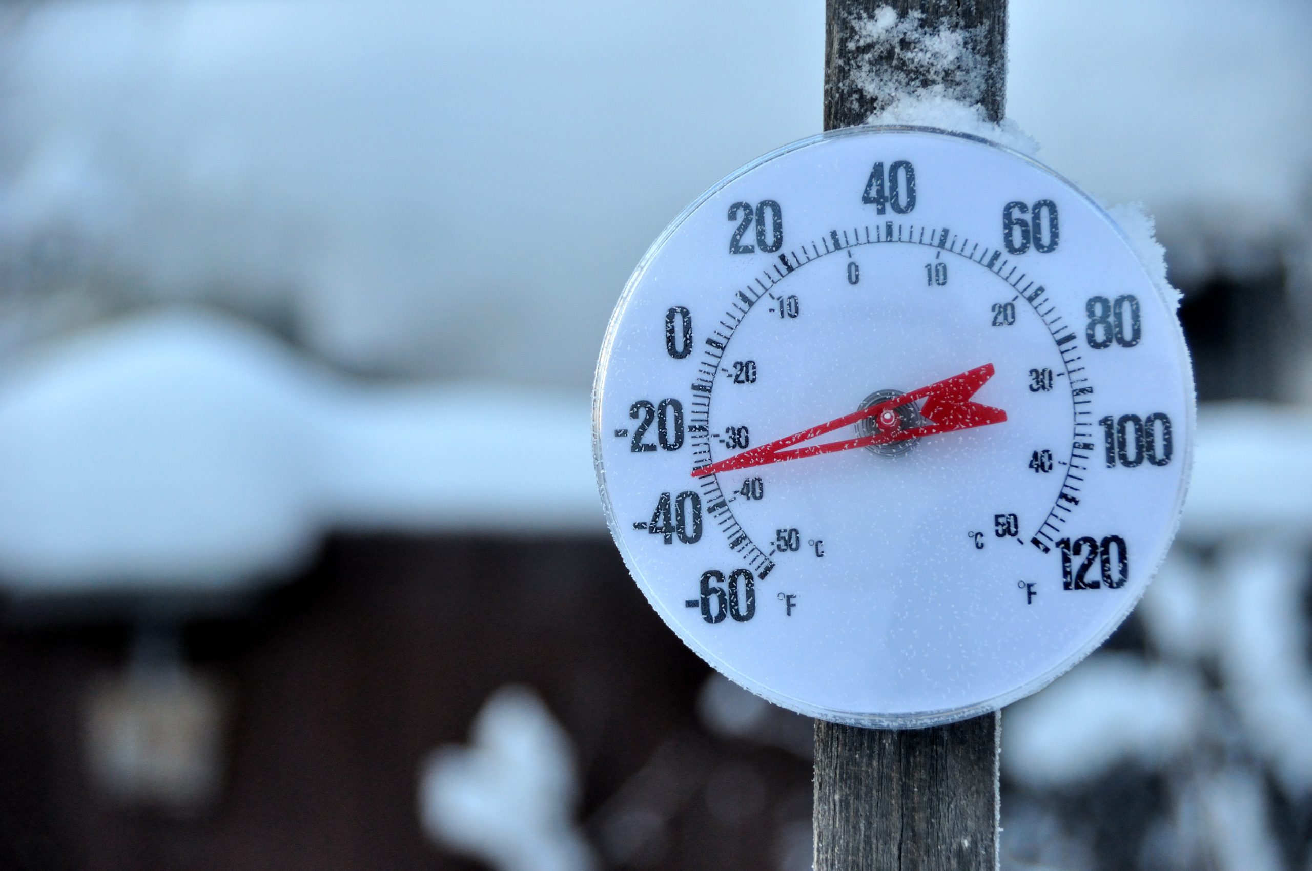
Next door, nearly all of Alberta was under an extreme cold alert, with temperatures there also expected to go as low as –50 C in the north, and –40 C throughout much of the rest of the province.LISTEN | Here’s why it’s ridiculously cold right now:
Edmonton AM6:44Why is SO cold outside? A climate scientist has an explanation
Edmonton is seeing an unusually long stretch of -25 to -30 temperatures due to disruptions in the polar vortex (artic wind system) which have become more frequent because of climate change. 6:44
And it was the same story in Saskatchewan. In Regina, it was even too cold to ice skate on what’s billed as the city’s biggest outdoor skating rink.
Forecast highs in Regina are –26 C on Wednesday and –29 C on Thursday, according to Environment Canada.
In Manitoba, the cold Arctic ridge is bringing overnight lows of –25 C to –30 C to southern Manitoba Tuesday night, Environment Canada said in its extreme cold warning. The wind chill will make it feel like –40 C.
Northern Manitoba will be even colder, with overnight lows dipping below –30 C and wind chill values of –45 or below expected.
Ontario shivers in the north, braces for high winds in the south
In Ontario, it was also all about the extreme cold in the north, with Environment Canada warning, “Frostbite can develop within minutes on exposed skin, especially with wind chill. If it’s too cold for you to stay outside, it’s too cold for your pet to stay outside.”
Steven Flisfeder, a warning preparedness meteorologist with Environment Canada and Climate Change, told CBC News that the region can expect “overall below seasonal temperatures” for much of the month of January.
“Even without the warnings, the temperatures are very, very cold. So limit your time outside as much as possible, and be sure to cover up exposed skin,” he said. “If you don’t have to be outside, then it’s safer to stay inside.”
In southern Ontario, there were special weather statements and warnings about high winds posted Tuesday, with gusts expected from 70 to 80 km/h Wednesday afternoon in the Greater Toronto Area and up to 90 km/h in the Kingston, Niagara, Simcoe, and Dunnville regions.
Free Speech and Alternative Media are under attack by the Deep State. Real News Cast needs reader support to survive. Please Contribute via GoGetFunding